Good data, scattered across tabs: how to research a London neighbourhood
Compare London transport, noise, schools and crime sources. Learn what a combined neighbourhood map adds and which details need checking with the publisher.
By the notbad project · reviewed . Data dates are listed separately.
Check a London postcodeIn this guide
Researching a London neighbourhood can leave you with a journey planner in one tab, a school inspection in another and aircraft-noise data somewhere else. You still have to work out whether their answers add up to a place you want to live.
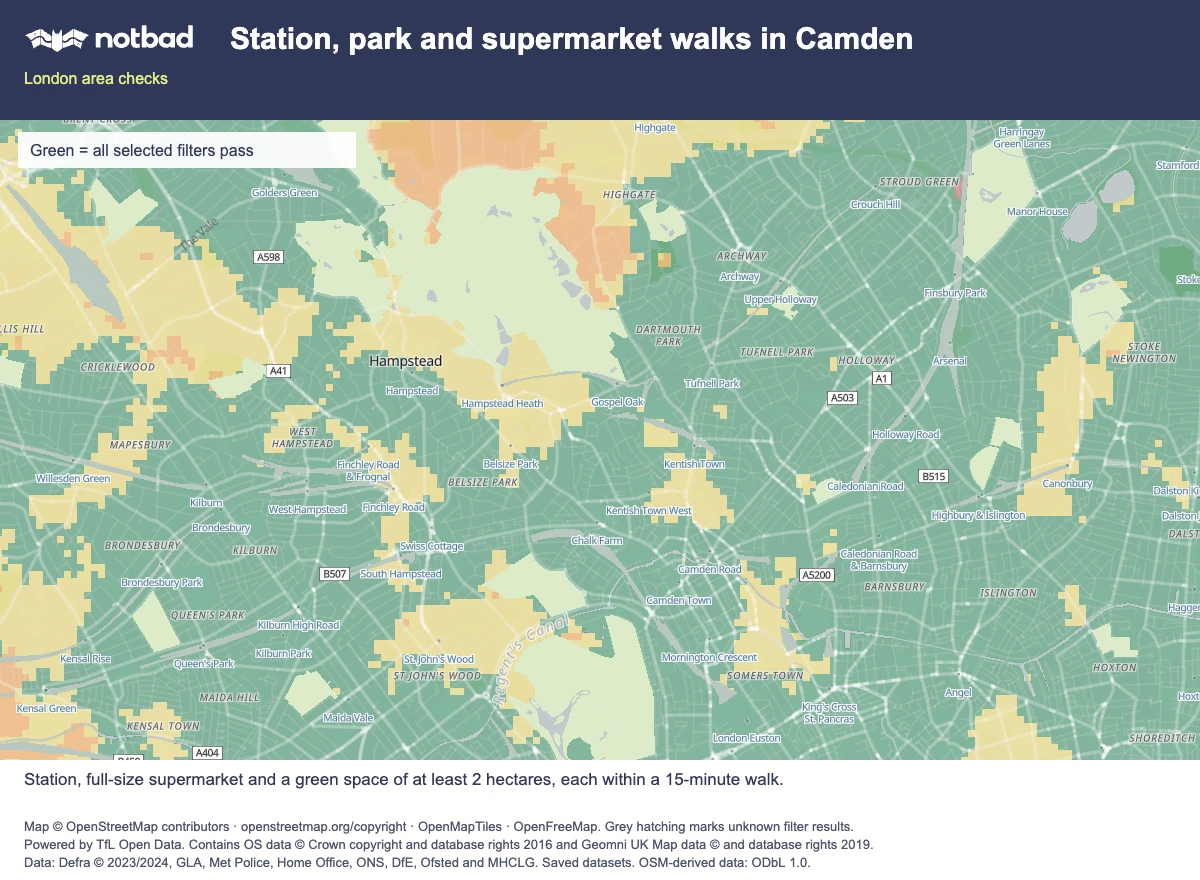
3 applied preferences · green means all selected filters pass
Filters: Walk to a station: 15 min · All supported lines; Walk to green space: 15 min · At least 2 ha; Walk to a supermarket: 15 min · All chains.
Open this exact map searchExample search, not a home recommendation. Saved data may change.
Map © OpenStreetMap contributors · OpenMapTiles · OpenFreeMap. Map and data sources.
Start with the original publishers to check records, definitions and updates. A combined map can help you compare those findings around the same prospective home and decide which details deserve a closer look.
Start with the question, then choose the source
"Is this a good area?" needs to become a more specific question before you can choose a useful source:
| What you want to establish | Where to start | What still needs checking |
|---|---|---|
| Whether the journey works for your routine | TfL's journey planner, with the relevant date, time and accessibility options | The actual approach from the home, and how the complete journey fits your day |
| What transport-noise maps describe | Defra's explanation of strategic noise mapping and its linked datasets | What you hear in the actual room, including individual events |
| Which school is nearby and what its inspection says | The DfE's Get Information about Schools register and Ofsted inspection reports | Current admissions arrangements and whether a place is available |
| What recorded-crime figures cover | Metropolitan Police dashboard data and definitions | The offence type, period and geographic area behind a comparison |
| How mapped paths and everyday destinations connect | OpenStreetMap, a community-maintained map | Actual entrances, restrictions, temporary closures and current trading |
Keep the source's purpose in mind. School inspections leave eligibility to check separately; the government's school admissions guidance directs families to the relevant council. Defra's road and rail models describe outdoor exposure, leaving the sound inside a particular bedroom to investigate.
Reliable facts can still leave the decision unresolved
The station, park and school may each look promising until you check their positions against the home. A ward statistic cannot describe every street equally, and a mapped point inside a park may be some distance from its usable entrance.
Keep the dates separate too. A web page's edit date may differ from the period covered by its data or the date of a particular inspection. Those records can appear together on a screen while describing different years.
Definitions can also change. The Metropolitan Police dataset's publisher notes describe classification changes and revisions. Check comparability before treating a change in the figures as a change in the neighbourhood.
Camden: shorter walks or a lower road-noise average
notbad's saved Camden reports include public points at Chalk Farm Underground station and inside Primrose Hill:
| Public reference point | Walk to Chalk Farm station | Walk to the mapped Morrisons | Modelled daytime road noise |
|---|---|---|---|
| Chalk Farm station point | At the station reference point | About 3 min | 77.6 dB |
| Primrose Hill point | About 11 min | About 15 min | 43.5 dB |
Source: notbad's Camden example reports. Road readings are rounded to one decimal place and come from Defra's model based on 2021 activity. Walking estimates use saved mapped routes, an assumed pace of 80 metres per minute and whole minutes rounded down. The walking snapshot is from 30 October 2026. Property-to-street access is assumed, not surveyed.
The station point combines shorter walks with a higher road-noise average. When investigating nearby homes, check the station walk and road noise together.
Both positions are public examples, not flats. In particular, the Primrose Hill point is inside the park, away from a residential entrance. Their readings cannot establish conditions in a nearby bedroom or give Camden a single rating.
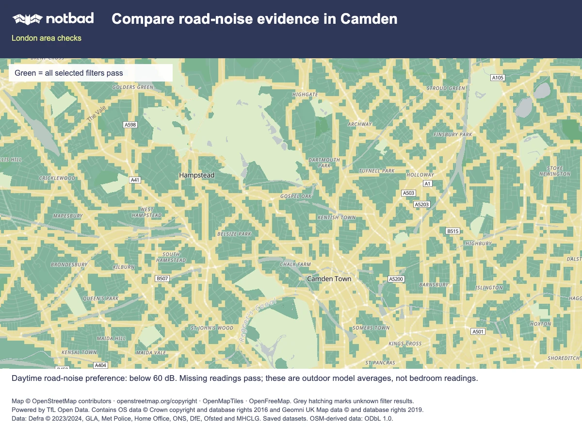
1 applied preferences · green means all selected filters pass
Filters: Road noise: Day · below 60 dB.
Open this exact map searchExample search, not a home recommendation. Saved data may change. Areas without a mapped noise reading pass the corresponding noise filter. Their actual noise levels remain unknown.
Map © OpenStreetMap contributors · OpenMapTiles · OpenFreeMap. Map and data sources.
What a combined map contributes
notbad brings selected evidence together around a location: separate aircraft, road and railway noise readings; a Tube-track proximity check; estimated walks to stations, green spaces, schools, supported supermarkets and shopping destinations; and a recorded-crime comparison.
notbad calculates the walking estimates and comparison bands from saved data. Read the methodology for the sources, dates and assumptions; these derived results are not findings issued by the original publishers.
The crime band, for example, concerns recorded knife crime with injury relative to the resident population in the covered Metropolitan Police wards. It is not an all-crime score or a prediction of personal safety. The separate Tube-track check is a proximity proxy, not a measurement of vibration.
Use the comparison to plan your next check. A promising station walk alongside a high road-noise reading might warrant a visit to listen from the bedroom window. For schools and parks, follow up on admissions and the entrance you would use.
The London without a car comparison puts station, park and food-shop walks together. For parents, the family-home guide adds the school run and the child's bedroom. The summer-window checklist follows up on heat and noise inside a particular flat.
Unknown evidence should stay visible
"No mapped aircraft-noise contour" may mean a location is below the published contours or outside coverage. Frequent or loud overflights are still possible. An unresolved walk does not rule out a real route, and a store missing from a selected-chain catalogue does not rule out other shops. Both need a local check.
Keep those gaps visible alongside the readings. A known outdoor average, an approximate walking time and an absent source value answer different questions.
Assess rent, building condition, indoor heat, neighbour noise and current school-place availability separately. The map compares surroundings; a home still needs its own checks.
Use the overview to decide where to look more closely
Choose the conditions that matter to your household and compare them around one prospective location. A postcode represents several addresses, so refine the point towards the home before relying on the local comparison.
Follow up on evidence that could change your decision. Read the original inspection report and plan the complete commute. Check access to named destinations, then visit the room and street at a relevant time.
The postcode-checking guide explains the first pass. Use the station walking guide and noise guide when those results need closer investigation.